NASA · Space
Greenland's Subglacial Topography Mapped
A new method reveals Greenland's hidden bedrock topography, including previously unknown valleys. This research offers insights into geologic history and could improve ice sheet projections.
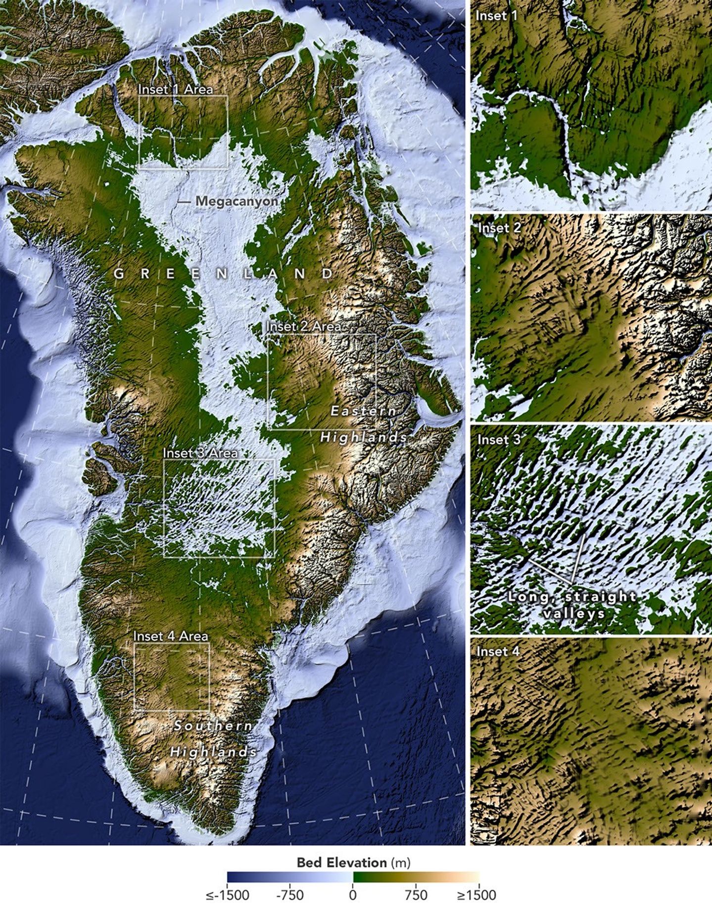
A new Ice Flow Perturbation Analysis method uses satellite data to map Greenland's subglacial terrain. Researchers mapped 1,943 subglacial valleys, identifying about a third as new. Many known valleys now extend farther inland.
Findings suggest many valleys originated in the highlands where the ice sheet first formed. Near the eastern highlands, a subglacial mountain range with valleys has been identified, potentially preserving landforms since the Pliocene.
However, long, straight valleys in the west-central region, aligned southwest-northeast, suggest a tectonic influence, which is puzzling.
The valleys' wide branching angles indicate a widespread groundwater network, not just surface water, likely aided their formation before the ice sheet existed.
Understanding these valleys is crucial for ice sheet dynamics, as ice flow concentrates in them, accelerating and deepening these features.
This improved understanding of subglacial topography is vital for predicting the ice sheet's future, as flow will continue concentrating in existing valleys during retreat.
AI-samenvatting op basis van de bron.
NASA