NASA · Space
Gandak River Flooding After Heavy Rains
Torrential rains in Nepal's Lumbini and Gandaki provinces caused the Gandak River to reach record high levels, leading to widespread flooding in Nepal and India.
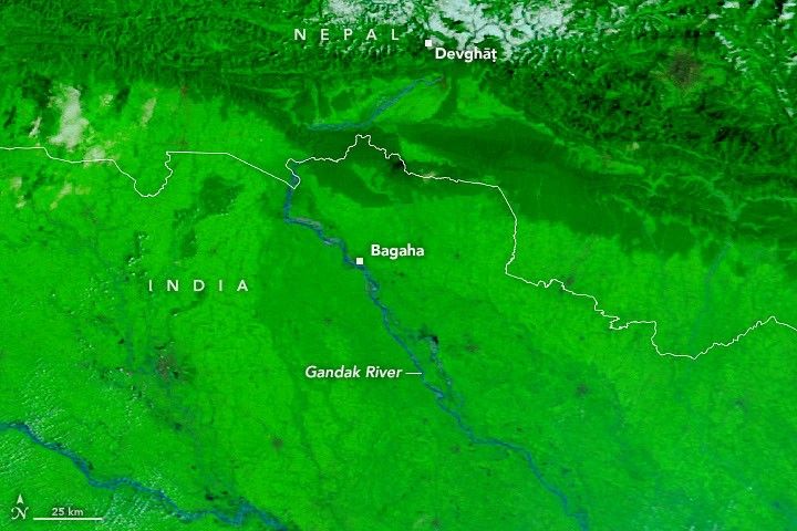
Between September 24 and 27, storms drenched mountainous regions of Nepal, triggering landslides and pushing the Gandak River (also known as the Narayani) to unprecedented levels. Runoff caused the river to overtop and breach embankments, inundating farmland and settlements for hundreds of kilometers.
News reports indicated that hundreds of villages were affected and thousands of people displaced by the flooding and landslides. False-color satellite images from NASA's Terra and Aqua satellites on September 20 and September 29, 2026, illustrate the significant expansion of the river's width.
The floodwaters inundated seasonal fields in low-lying river areas, known as diara. However, the flooding also breached embankments, affecting settled areas including parts of Bagaha, Areraj, and Fulia Khand.
Data from Nepal's Department of Hydrology and Meteorology showed a gauge in Devghāṭ reaching 11.94 meters on September 27, the highest recorded since measurements began in the 1960s.
In India, gauges in Bagaha, Dumariaghat, Rewaghat, and Lalganj also reported new high-water marks along the Gandak River.
AI-samenvatting op basis van de bron.
NASA