NASA · Space
Pacific Storms Intensify During Busy 2026 Tropical Cyclone Season
The northeastern and central Pacific basins are experiencing an unusually active 2026 tropical cyclone season, with 20 named storms and nine hurricanes recorded by late September, exceeding the 1991-2020 average.
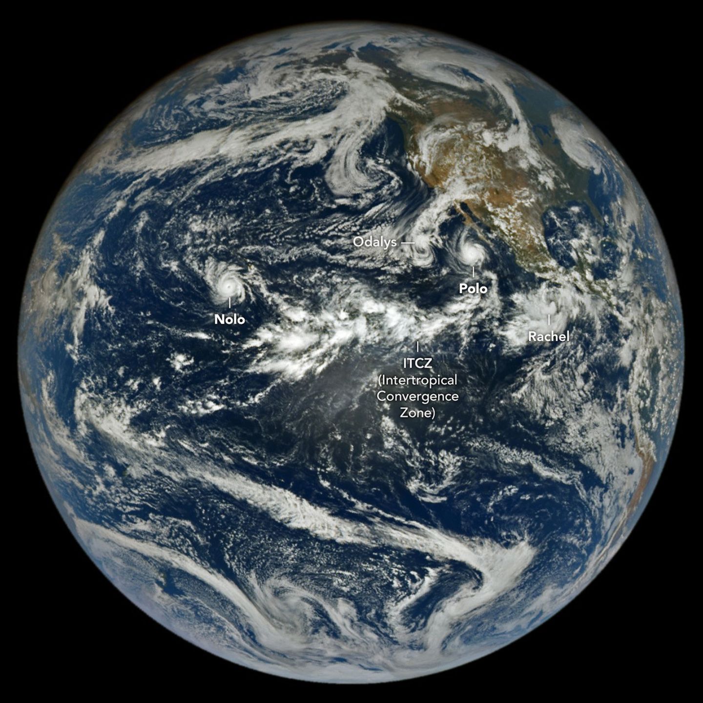
NASA's EPIC camera captured images of powerful storms, including Hurricane Nolo near Hawaii and Hurricane Polo off Baja California. Tropical Storm Rachel and Post-Tropical Cyclone Odalys also contributed to hazardous conditions along the Mexican coast and in the southwestern U.S.
Hurricane Polo underwent rapid intensification to Category 5 before making landfall in Baja California Sur as a Category 2 storm. It later made a second landfall near Guaymas, with warnings issued for dangerous winds, storm surge, and flooding in Baja California Sur and Sonora.
The remnants of Polo, combined with moisture from Odalys, were expected to bring heavy rain and flood risks to the southwestern U.S. and southern Plains.
Tropical Storm Rachel was tracking parallel to the southwest Mexico coast, bringing strong winds and dangerous surf. Hurricane Nolo, while not making landfall, caused significant rainfall, flooding, and landslides on parts of Hawaii.
Accumulated cyclone energy in the Northeast Pacific was more than double the norm as of September 28. Scientists attribute the increased activity to an ongoing El Niño, which typically promotes tropical storm development through warm equatorial Pacific waters and low wind shear.
The NASA Disasters Program is supporting Hawaii's response to Hurricane Nolo, providing maps and data on its open-access mapping portal.
AI-samenvatting op basis van de bron.
NASA