NASA · Space
Hurricane Polo Undergoes Explosive Intensification
Hurricane Polo rapidly intensified off Mexico's Pacific coast in September 2026, reaching Category 5 strength. Scientists described the event as "explosively rapid intensification" due to a near-perfect environment for strengthening.
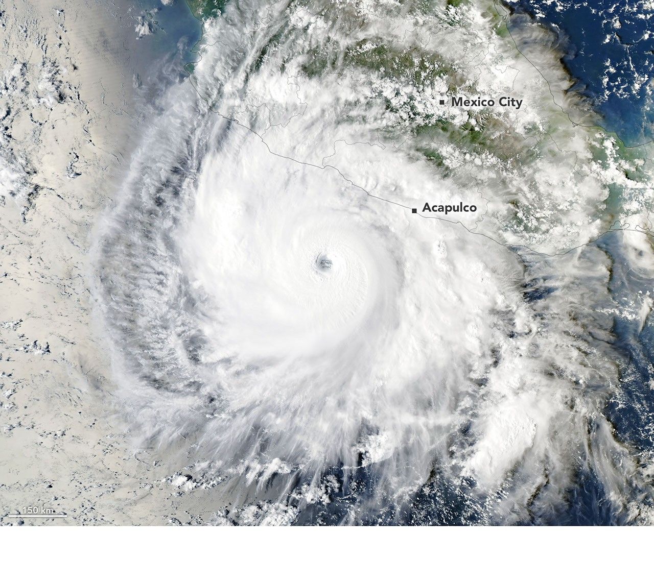
Polo quickly organized, undergoing extreme rapid intensification (at least a 60-knot wind speed increase in 24 hours). By September 22, winds reached Category 5 strength, a 90-knot increase. It may be the third-strongest eastern Pacific storm and fastest to reach Category 5 from a depression.
On September 23, Polo was a Category 4 storm with 230 km/h winds. Its large, clear eye and extensive outflow pattern were noted, with weak upper-level winds and good outflow aiding intensification.
The storm moved over unusually warm sea surface temperatures, reaching 32°C (90°F), 2-3°C warmer than average. Waters exceeded the 27.8°C (82°F) threshold needed to sustain hurricanes.
Data showed sea surface temperature anomalies, indicating warmer-than-average ocean conditions. Deeper warm water likely contributed to the storm's staying power, with minimal churning of cooler water.
Scientists cautioned against directly attributing intensification to El Niño, as it has occurred during La Niña and neutral conditions. However, El Niño typically increases eastern Pacific tropical cyclone activity.
As of September 24, accumulated cyclone energy in the region was nearly double the norm. Forecasters anticipated Polo would remain over the Pacific before potentially curving toward Baja California.
AI-samenvatting op basis van de bron.
NASA