Carbon Brief · Climate & nature
Super El Niño Reaches Record Levels
This year's "super El Niño" has reached record sea surface temperatures in the tropical Pacific, tying the 2015 daily record. The event, ongoing since June, is developing faster than any previous El Niño.
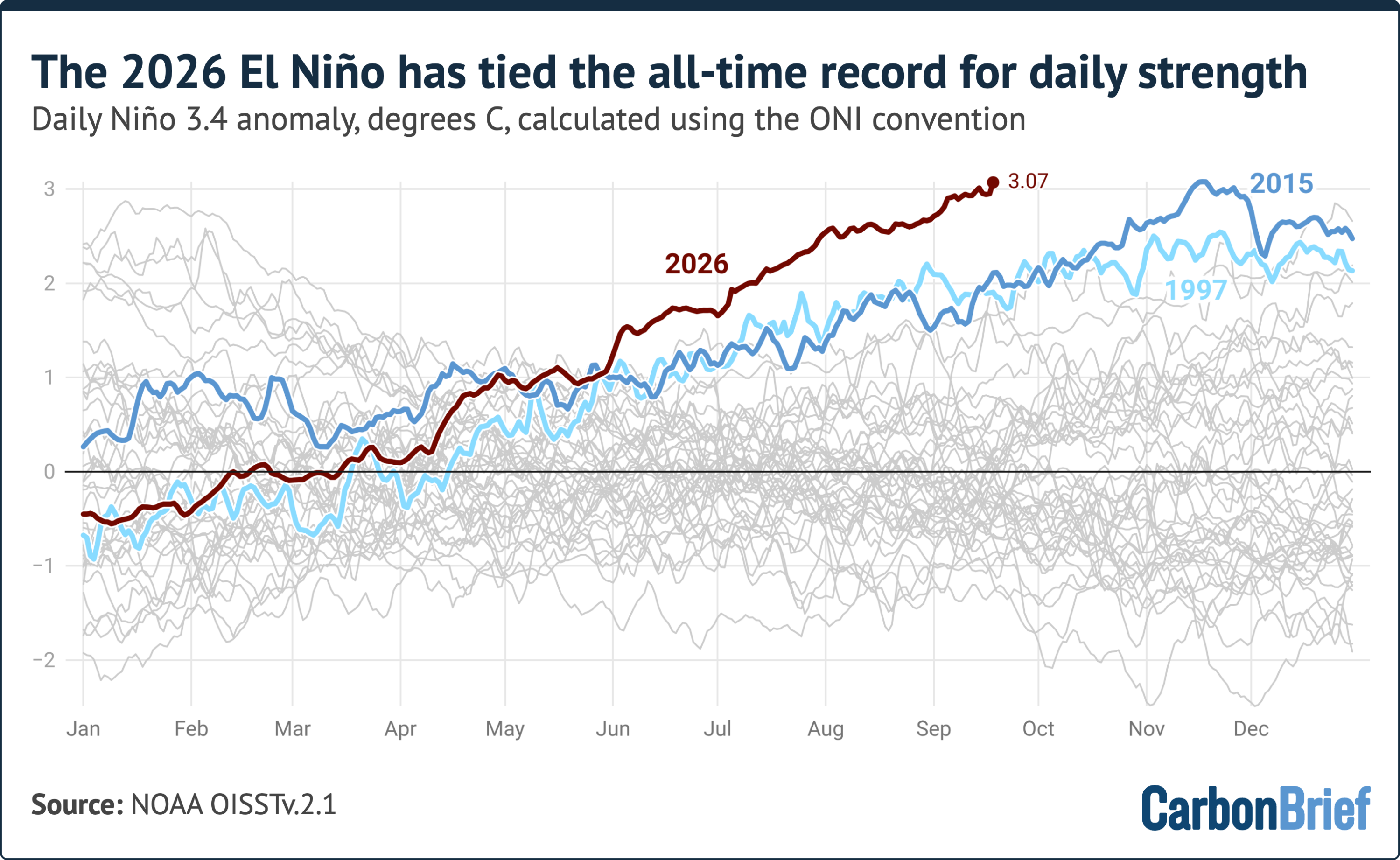
The "Niño 3.4 anomaly" measures warmer sea surface temperatures. As of September 19, it reached 3.07C, tying the 2015 record. This is notable as El Niño typically peaks in winter.
El Niño events are classified by anomaly strength: weak (0.5C), moderate (1C), strong (1.5C), and very strong (2.0C). The current 3.07C anomaly matches the "very strong" 2015 event.
Using a 1991-2020 baseline, the current El Niño has set a new record for strength since June, exceeding 1997 and 2015 levels.
An alternative metric, RONI, adjusts for warming. RONI values are record-setting for this time of year but below the 1982-83 record. Past strong events strengthened significantly after mid-September.
Forecast models project a peak monthly anomaly around 4.1C later this year, exceeding the 2015-16 record. All model runs predict a stronger event.
Caution is advised as forecast systems haven't been tested on events this large. Models also slightly overestimated recent observed temperatures.
If forecasts hold, the event will peak between November and January, far exceeding previous observations. Impacts on global temperatures will likely be felt in 2027.
AI-samenvatting op basis van de bron.
Carbon Brief