NASA · Space
Agricultural "Island" in Saskatchewan River Delta
NASA Earth Observatory satellite images highlight a unique agricultural area within the largely wetland Saskatchewan River Delta in Manitoba, Canada. This region, known as the Carrot River Valley, stands out with its distinct, straight-edged fields amidst the delta's natural waterways and marshes.
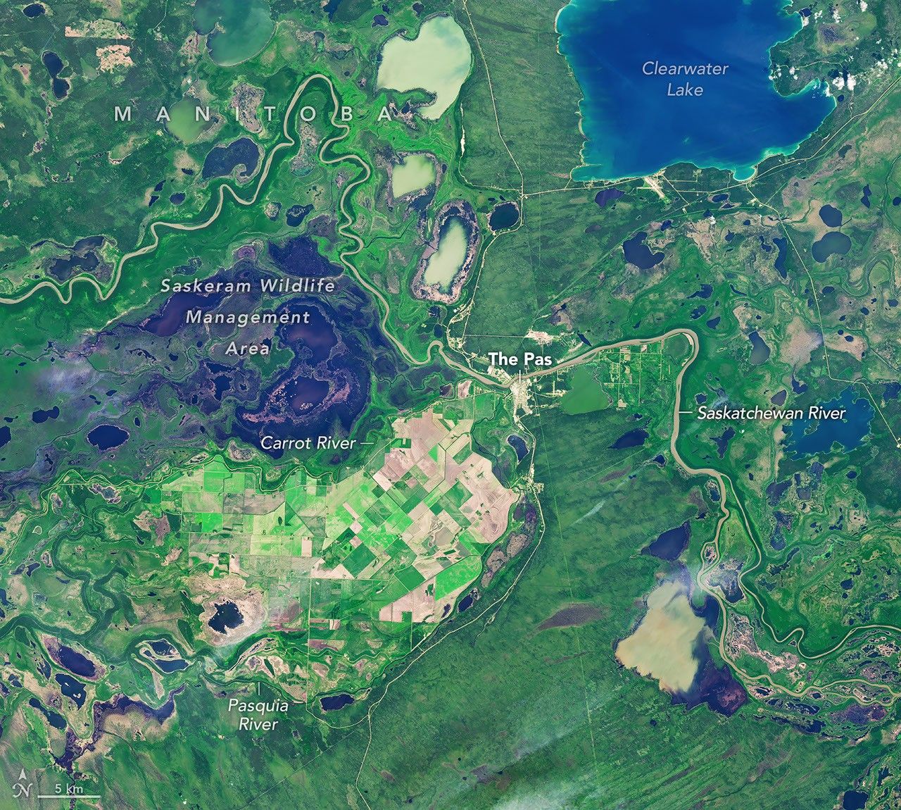
The Carrot River Valley, Manitoba's northernmost farming area, spans over 40,000 hectares between the Carrot and Pasquia rivers. It is surrounded by wetlands, including the Saskeram Wildlife Management Area.
Images captured by Landsat 9 and Landsat 8 satellites on July 2 and September 21, 2026, show the valley's transition from summer growth to harvest. Planting was delayed due to wet conditions, but fertile soil and long daylight hours aided crop development.
By September, the fields were largely harvested, contrasting with other parts of the region where wet weather delayed agricultural activities. Farmers in the valley primarily grow canola and spring wheat, with some Canary seed.
Water management has historically been a challenge in the valley. A significant flood control and drainage project was initiated in the 1950s, and current farming practices rely on diking and pumping for flood protection.
AI-samenvatting op basis van de bron.
NASA