NASA · Ruimte
Three Pacific Tropical Cyclones Visible Simultaneously
In early September 2026, NASA's EPIC camera captured an image showing three tropical cyclones active in the Pacific Ocean, alongside one in the Atlantic. This aligns with spring forecasts predicting above-normal activity in the northeastern and central Pacific due to El Niño, while the Atlantic remained unusually quiet.
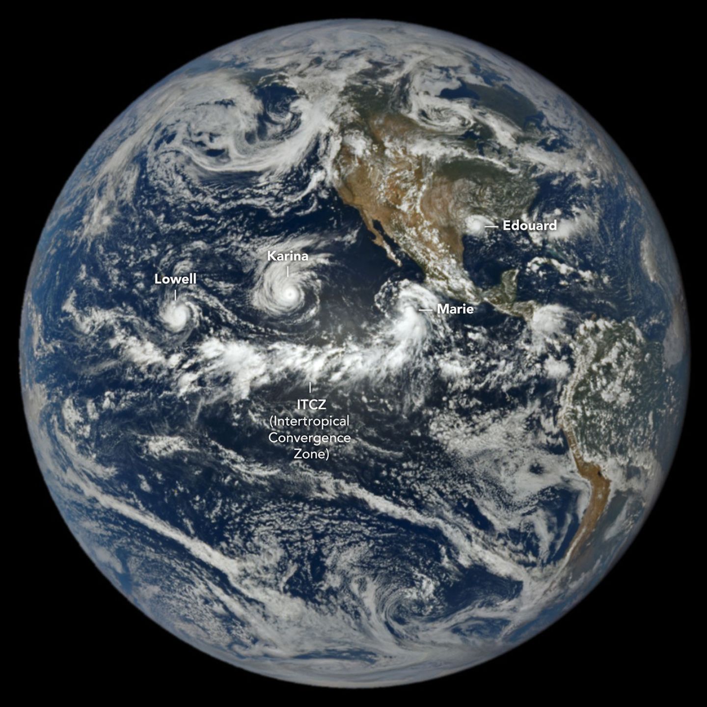
As of September 3, the Northeast Pacific had recorded 15 named storms and six hurricanes, significantly exceeding the seasonal average. Conversely, the Atlantic basin had only five named storms and no hurricanes, attributed to unfavorable wind shear conditions. El Niño typically boosts Pacific hurricane activity through warmer ocean temperatures and suppresses Atlantic activity by altering circulation patterns.
The image, taken on September 1, 2026, by NASA's EPIC camera on the DSCOVR satellite, showed Pacific storms Lowell, Karina, and Marie. Lowell reached Category 5 strength, and Karina achieved Category 4 strength simultaneously, a rare occurrence. Marie was a strengthening tropical storm at the time. In the Atlantic, Tropical Storm Edouard had recently made landfall in Louisiana and Texas, causing heavy rainfall and wind damage.
The accumulated cyclone energy (ACE) index for the Atlantic basin was 4.4 (9% of normal), while the Northeast Pacific's ACE was 130 (50% above normal). The ACE index measures both storm intensity and duration. NASA's Earth-observing platforms provide data for hurricane preparedness and damage assessment.
AI-samenvatting op basis van de bron.
NASA